December 29, 2010 - January 3, 2011
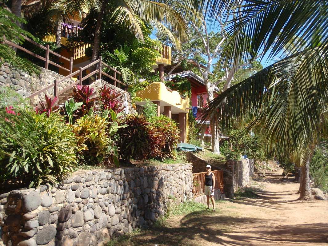
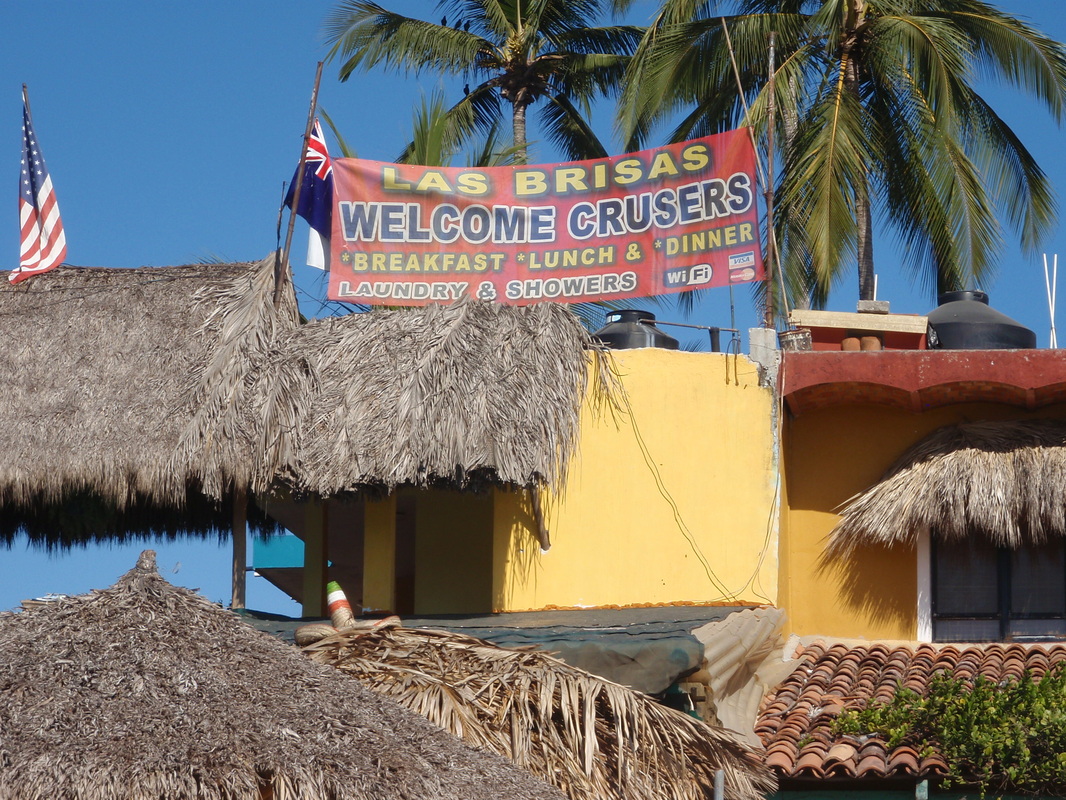
The passage from Mazatlan to Bahia de Banderas (Banderas Bay) is about 190 miles, which we broke up into three legs: Mazatlan to Isla Isabel (93 miles); Isabel to Ensenada Chacala (55 miles); and Chacala to La Cruz de Huanacaxtle (43 miles). Isla Isabel (or Isabela), which lies about 18 miles offshore about midway between Mazatlan and Punta de Mita (at the north entrance to Banderas Bay), is sometimes referred to as “The Galapagos of Mexico” and is a “must see” stop on this passage, although anchoring there can be a challenge (more on this below). Chacala is a quaint little seaside town on the mainland, just south of San Blas and Ensenada de Matanchén, with a small but beautiful palm tree-lined sand beach with several palapas (palm-thatched roof open-air restaurants and bars) where you can enjoy a cold cerveza or fresh fish meal. Banderas Bay, one of the largest natural deepwater bays in Mexico is 23 nautical miles across from Punta de Mita to the southern point at the notorious Cabo Corrientes (Cape of Currents) and 20 miles deep from west to east, and is home to Puerto Vallarta and Nuevo Vallarta on the eastern shore. We chose to make our “landfall” at La Cruz, on the north-eastern shore of the Bay, because it is a small, laid-back town with a new marina (Marina Riviera Nayarit), great restaurants and markets, and a renowned “music scene” at venues such as Ana Banana’s and Philo’s Bar.
MAZATLAN TO ISLA ISABEL
We left Mazatlan late in the day (4:00 pm) on Wednesday, December 29, after a 17-day stay that included Christmas with palm trees, sunshine and 78° weather! The reason for the late departure was to time our arrival at Isla Isabel for just after sun-up; it’s never a good idea to enter an unfamiliar anchorage in the dark. We use 6 knots as our “planning speed” for passages – if we motor, we average about 6.2 – 6.4 knots; if we sail, we try to average at least 5 knots of progress toward our destination; sometimes it can be over 7 knots, or under 4. In this case, 93 nm @ 6 knots with a 4:00 pm departure would put us into Isla Isabel at 7:30 am (sunrise was just before 7).
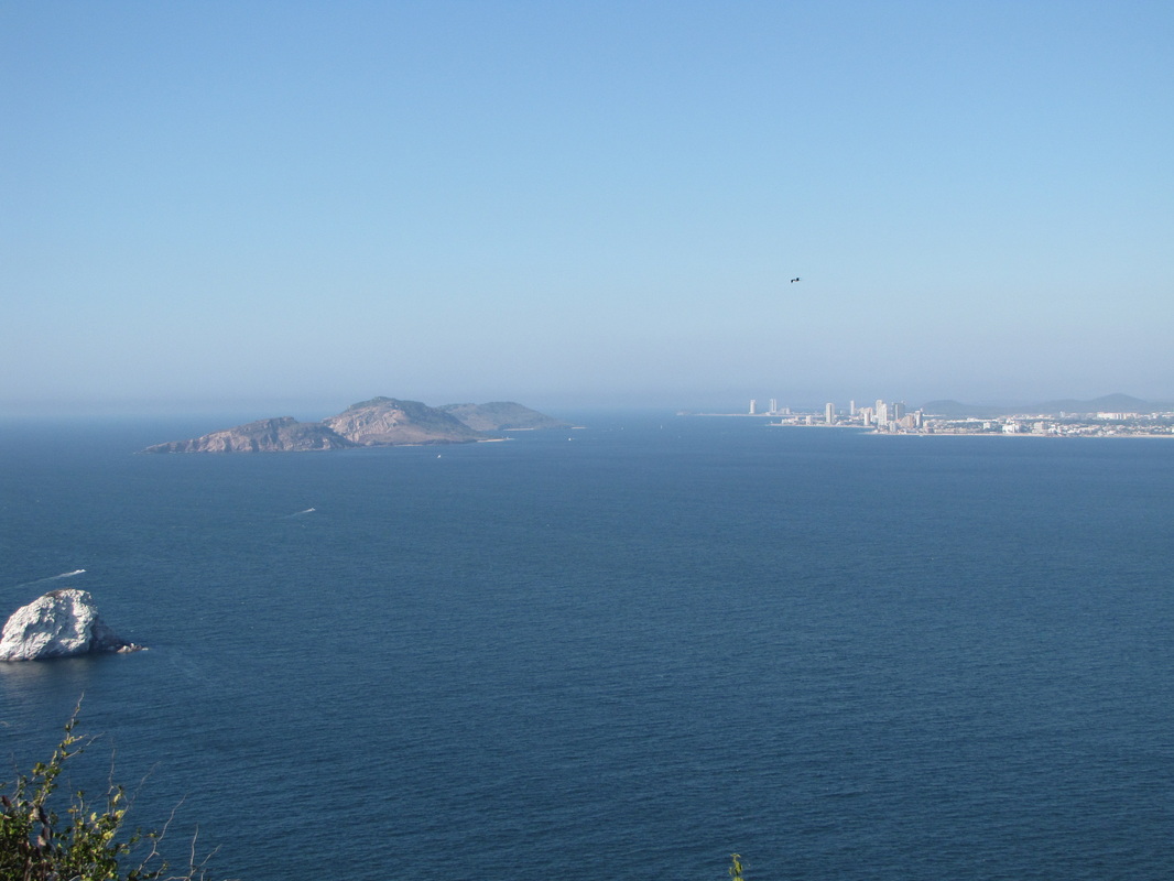
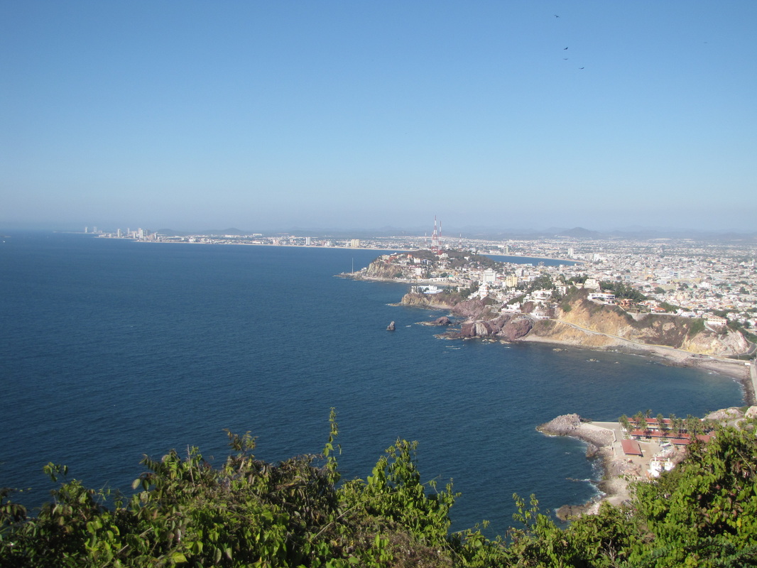
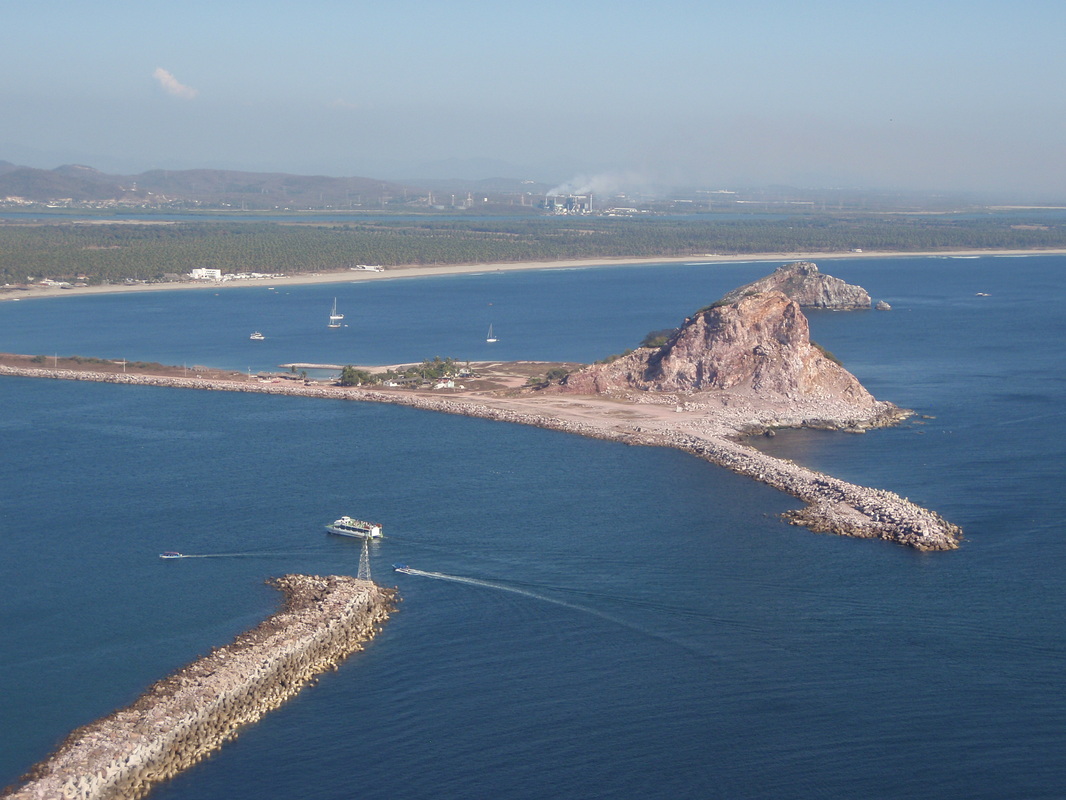
As we eased out around the trio of beautiful islands just off Mazatlan’s Zona Dorada (“Gold Coast” – the tourist zone) the sun was low, and so was the wind – 7 knots or less, so we continued motoring. As we passed Bahia Olas Altas, the beach right in front of old town Mazatlan, we saw several humpback whales breaching less than a mile offshore – always a thrilling sight. And as we passed Isla Creston at the entrance to Mazatlan’s harbor with its navigation light perched high atop its southern peak, we were reminded of our hike to the light house just a few days before, and the wonderful views of the city from that lofty perch.
(For larger images, captions, and slide show - advance with arrow - click on any image in the photos groups, below.)
MAZATLAN TO ISLA ISABEL
We left Mazatlan late in the day (4:00 pm) on Wednesday, December 29, after a 17-day stay that included Christmas with palm trees, sunshine and 78° weather! The reason for the late departure was to time our arrival at Isla Isabel for just after sun-up; it’s never a good idea to enter an unfamiliar anchorage in the dark. We use 6 knots as our “planning speed” for passages – if we motor, we average about 6.2 – 6.4 knots; if we sail, we try to average at least 5 knots of progress toward our destination; sometimes it can be over 7 knots, or under 4. In this case, 93 nm @ 6 knots with a 4:00 pm departure would put us into Isla Isabel at 7:30 am (sunrise was just before 7).
As we eased out around the trio of beautiful islands just off Mazatlan’s Zona Dorada (“Gold Coast” – the tourist zone) the sun was low, and so was the wind – 7 knots or less, so we continued motoring. As we passed Bahia Olas Altas, the beach right in front of old town Mazatlan, we saw several humpback whales breaching less than a mile offshore – always a thrilling sight. And as we passed Isla Creston at the entrance to Mazatlan’s harbor with its navigation light perched high atop its southern peak, we were reminded of our hike to the light house just a few days before, and the wonderful views of the city from that lofty perch.
(For larger images, captions, and slide show - advance with arrow - click on any image in the photos groups, below.)


Just after dark, on a glassy seaway with very little swell, the first of two cruise ships left Mazatlan headed for Puerto Vallarta. These ships approached us from behind, but both were headed further offshore than us so they were well clear. With all of their lights on several decks these “floating cities” are quite a sight at night, and can be seen as a glow on the horizon even after they have disappeared from view! Other than a couple of fishing boats that we left behind shortly after the lights of Mazatlan disappeared behind the stern rail, one mega-yacht headed north to Mazatlan, and one other sailboat about five miles further out than us going in the same direction but faster (so we lost sight of him in a few hours), we were once again alone at sea – or so we thought. Just after dinner, around seven o’clock, we settled into our 3-on, 3-off watch schedule; I had the first watch (until 9 pm), Linda the next at 9-12. An hour before her watch ended, and while I was fast asleep in the “sea berth” (the starboard settee in the main cabin, made-up with a lee cloth), Linda was visited by a large pod of dolphins – all streaming the most incredible trails of phosphorescence (bioluminescence) as they darted back-and-forth under and around the boat, and throwing showers of light as they leapt out of the water! Wow! What a time to be sleeping; oh well, at least I got the moonrise on my next watch at 2:30 am! (Nice, but not quite as spectacular!)
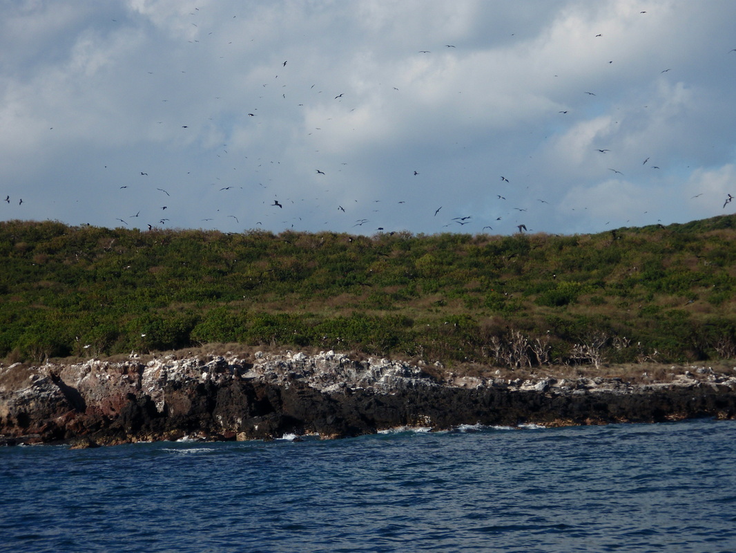
As we approached Isla Isabel around 7 am on December 30, the sun was just about to make its appearance for the day, accompanied by a few clouds which made for a beautiful sunrise! Linda stayed up after her 3-6 am watch, because we would be anchoring soon (a team sport), and because I needed an extra set of eyes to keep a sharp look-out for fish nets. There is a fishing village on the south side of Isabel, and the fishermen set nets as much a mile or two from the island, often marked by nothing more than a small plastic milk bottle – which are very hard to see until you are quite close! (Running over a fish net can ruin a lot more than the net, especially if it gets caught in the prop!) While we looking for fish nets as we neared the island, we saw several humpback whales off the east side of the island, as well as a sea turtle and a manta ray jumping out of the water! This place was turning out to be very interesting before we even got the hook down!
As we approached Isla Isabel around 7 am on December 30, the sun was just about to make its appearance for the day, accompanied by a few clouds which made for a beautiful sunrise! Linda stayed up after her 3-6 am watch, because we would be anchoring soon (a team sport), and because I needed an extra set of eyes to keep a sharp look-out for fish nets. There is a fishing village on the south side of Isabel, and the fishermen set nets as much a mile or two from the island, often marked by nothing more than a small plastic milk bottle – which are very hard to see until you are quite close! (Running over a fish net can ruin a lot more than the net, especially if it gets caught in the prop!) While we looking for fish nets as we neared the island, we saw several humpback whales off the east side of the island, as well as a sea turtle and a manta ray jumping out of the water! This place was turning out to be very interesting before we even got the hook down!

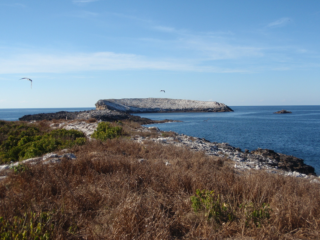
The charted location of Isla Isabel is another classic example of why one has to be very careful in navigating Mexican waters – even the paper charts caution that the actual location of Isabel is reportedly as much as a mile and three-quarters further south than shown on the chart. We have found the GPS waypoints in Shawn Breeding and Heather Bansmer’s cruising guides (Sea of Cortez and Pacific Mexico) to be very accurate, so we use them in navigating anywhere near islands or shore. In our approach to Isla Isabel, we were navigating to waypoint “NAY001” (which is their waypoint #1 in the Mexican State of Nayarit) – about ¾ mile to the NE of the island in 80 feet of water. When we were just over a mile north of that waypoint, our chart plotter showed Bright Angel crossing right over the center of the mile-long island! That would be a bit disconcerting if you were not expecting the charting error!
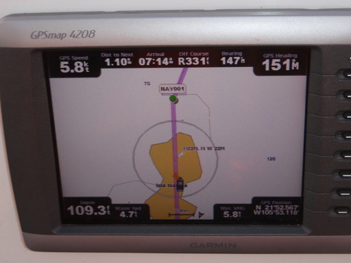
Chart plotter showing us crossing the middle of Isla Isabel, while we were still almost 2 miles to the NE of the island!
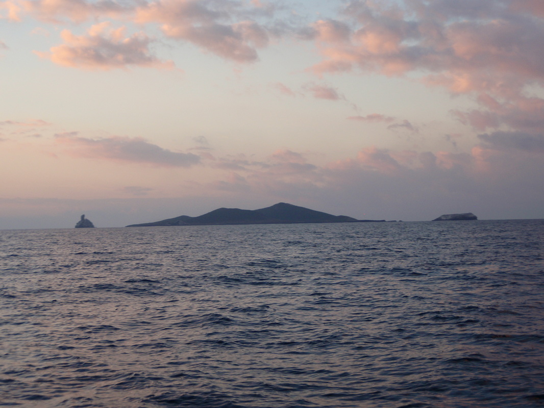
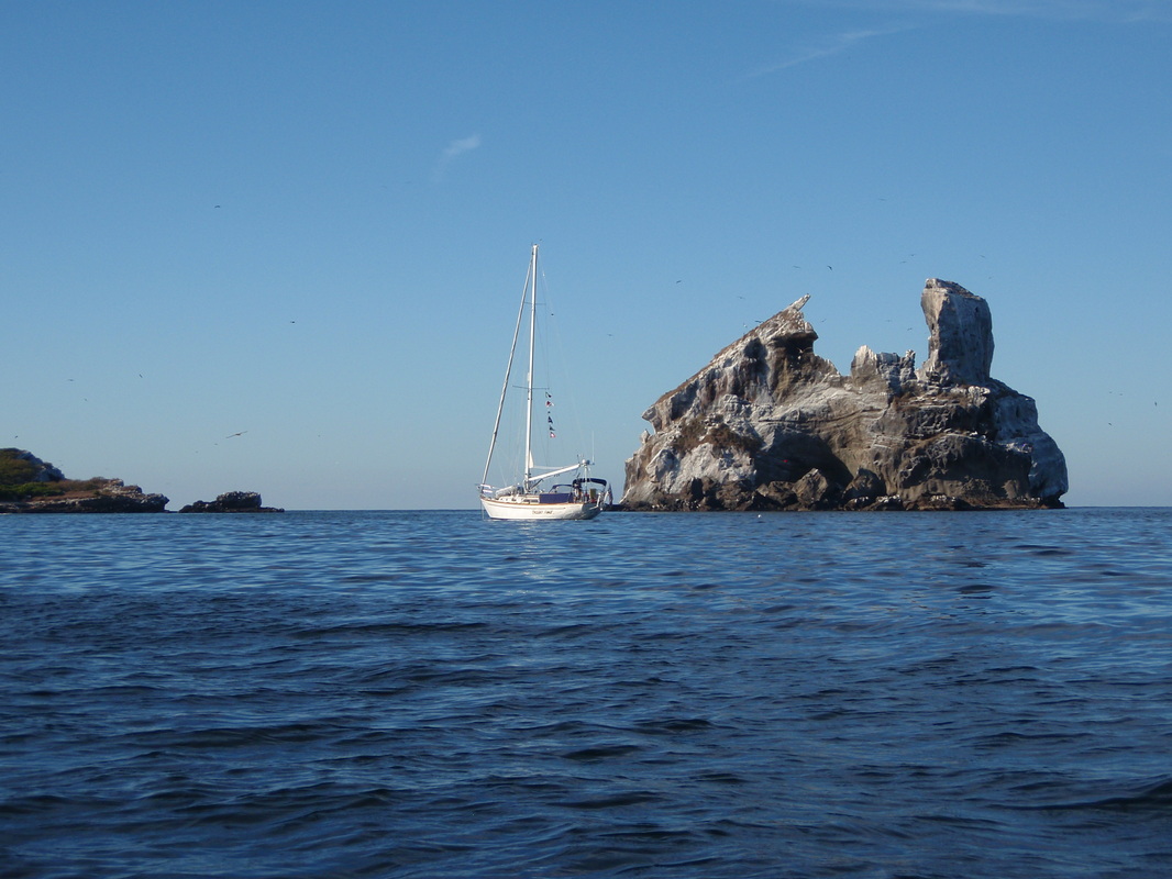
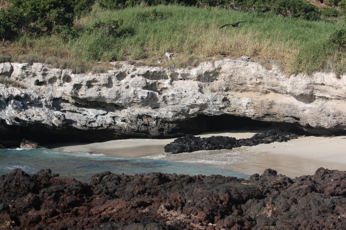
Anchoring at Isla Isabel can be a challenge. There are only two possible places to anchor at Isabel – in the small bay on the south side of the island, or off the east side of the island, just south of two rock pinnacles named collectively Las Moñas (which means the mannequins, or women’s dressmaking form) – Isleo Moña Mayor (“larger”) to the north, and Isleo Moña Menor (“smaller”) to the south. Both anchorages are rock strewn, and in Breeding and Bansmer’s guide they note that “[b]ecause of the rocky nature of the sea floor surrounding Isla Isabel, this bottom has probably ‘swallowed’ more anchors than any other anchorage in Pacific Mexico.” However, there are some sandy patches closer to Isla Moña Menor that are not found elsewhere – so, we decided to try our luck there, even though Breeding and Bansmer caution that one should “not be lured into a false sense of security, as the sand is thin and lies over a rock bottom.” Because of these conditions, it is highly recommended to rig a trip line to the crown of your anchor, in turn tethered to a surface float, so you at least have a chance of retrieving your anchor should it become fouled in a rocky crevice. (Are we having fun yet?)
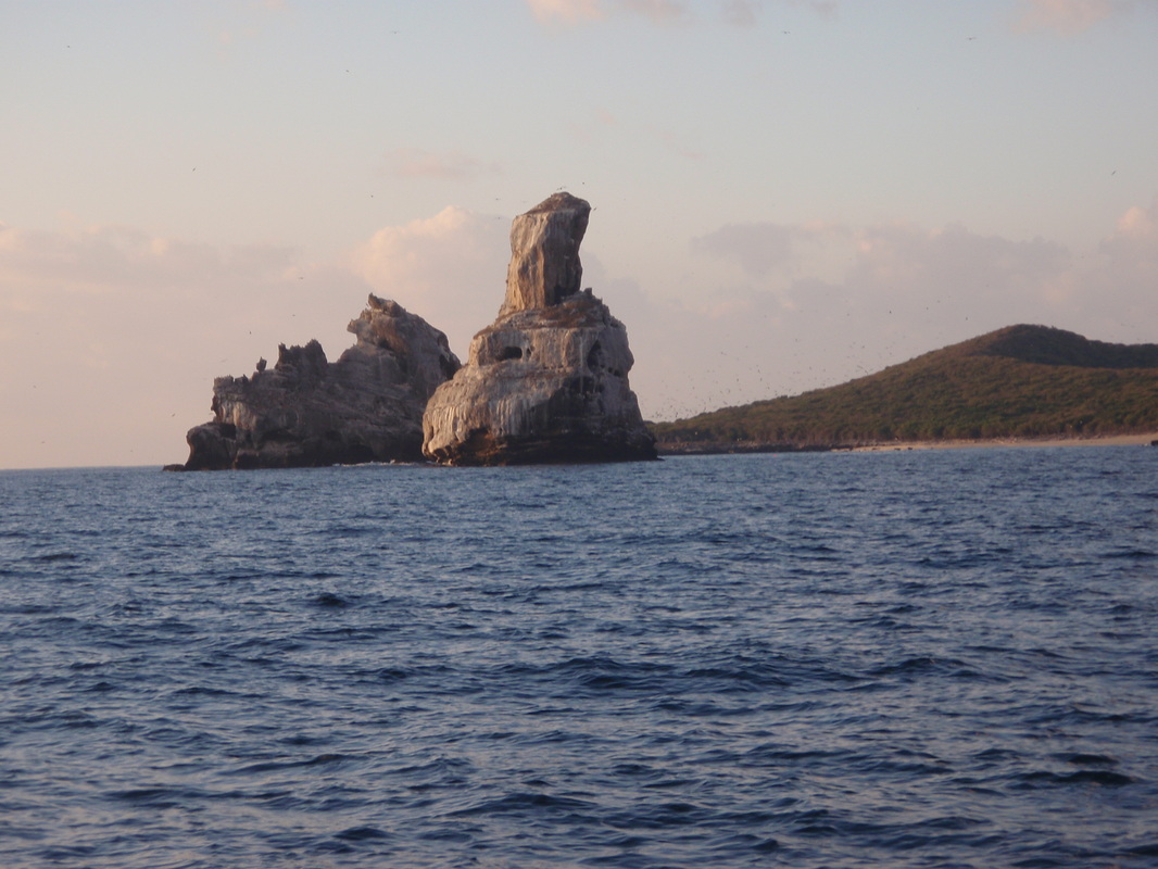
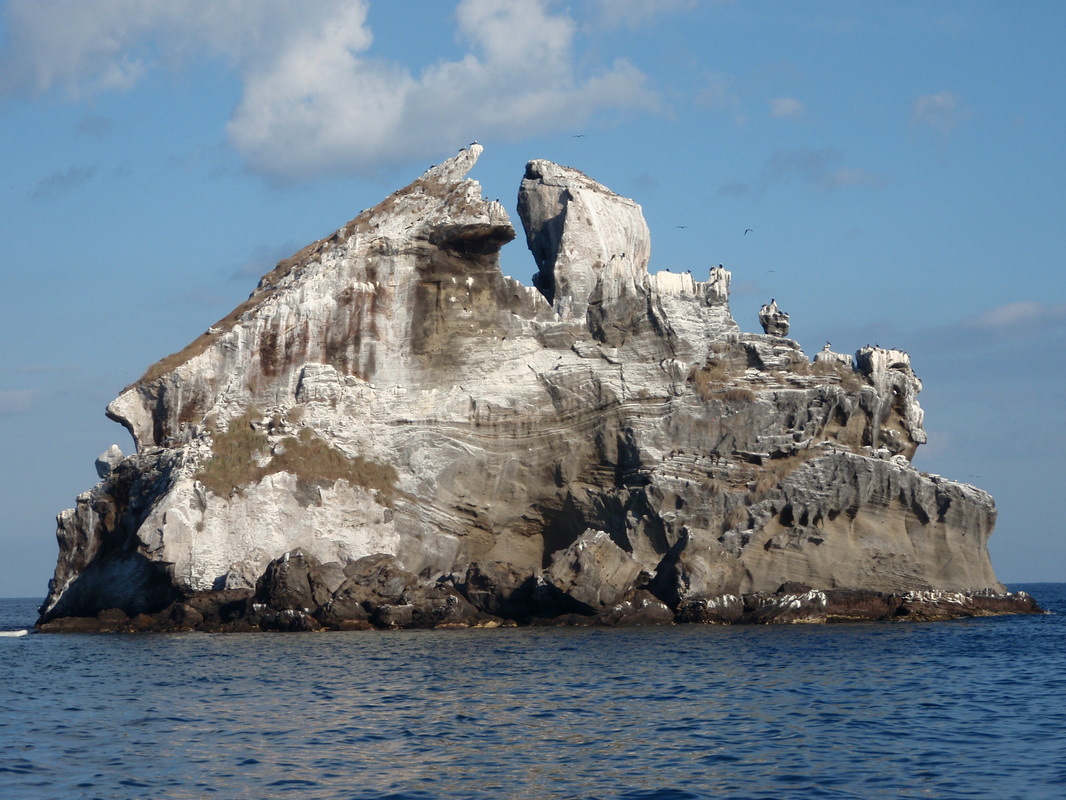
There was one other boat anchored just south of Isleo Moña Menor when we arrived, so we picked a spot a little further south yet, in about 18-20 feet of water, in which we could see sand patches on the bottom. We rigged and deployed a trip line, as recommended, and after we got the hook down, we backed down as usual to make sure the anchor was set. We felt the chain bump over some rocks at first, but then the boat stopped backing, so we thought we were firmly hooked and we shut the engine down. After a quick breakfast in the cockpit, where we delighted in the whales breaching off shore and the thousands upon thousands (maybe even a bazillion) birds - mostly frigate birds and boobies - flying over the island and perched in the trees, Linda decided to take a nap and catch up on a few winks lost during our overnight passage from Mazatlan. I decided to launch my inflatable kayak and take a spin around the anchorage – even from the boat the colorful tropical fish that could be seen swimming by were amazing, and there were manta rays leaping out of the water near Las Moñas!
After paddling around a while, I decided to take a closer look at the set of the anchor – which was easy to find with the trip line float. What I saw very clearly in the 20 feet or so of crystal clear water was a little disconcerting, to say the least! Our trusty Rocna anchor was lying on its side on a large slab of rock, which was only lightly dusted with sand, with its shank pointing away from the boat. I followed the chain as it lead away from the anchor and disappeared over the edge of the rock slab about 10 feet away, only to reappear about 10-15 feet to the south, over another rock ledge, leading back to the boat. We were not anchored at all, but held only by the chain draped over the edge of a rock slab. This was definitely not good!
I paddled back to the boat, secured the kayak alongside, and woke Linda from her nap. I told her of our anchoring plight, and that we would have to weigh anchor and try again. This time, after finding what looked like a fairly large patch of sand, we dropped the anchor in 25 feet of water. When went to back down we heard the chain dragging over rock, felt it bump a time or two, then “thunk” – it grabbed hold with a jerk. We let the chain settle, then backed down again; this time, too, the boat jerked to a stop, and the chain was high when we stopped – we were firmly hooked, but on a rock, I was afraid. Fortunately, we had the trip line to help retrieve the anchor, if necessary – but wait, where was it? I could not see the float, which was our orange, 14-inch round fender, tethered to the anchor crown with 35 feet of floating polypropylene line. Finally I spotted the float – about 1 ½ feet under the waves! Even though we dropped anchor in 25 feet, and backed down toward the island, the anchor had apparently fallen into a “hole” and pulled the float down with it! I made a lasso out of 15 foot length of dock line, tied it to a small, white Styrofoam anchor trip line float, paddled back out to the sunken buoy and managed to get the lasso over and pulled up tight under the orange float. Good to go!
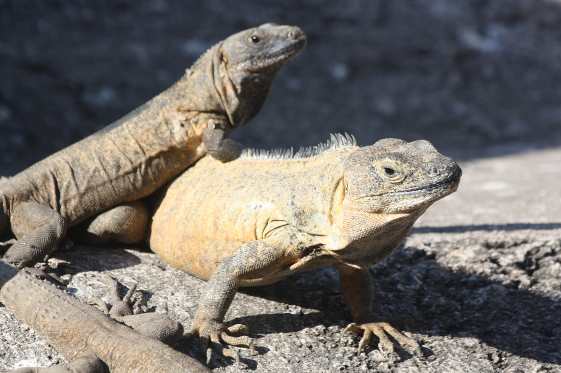
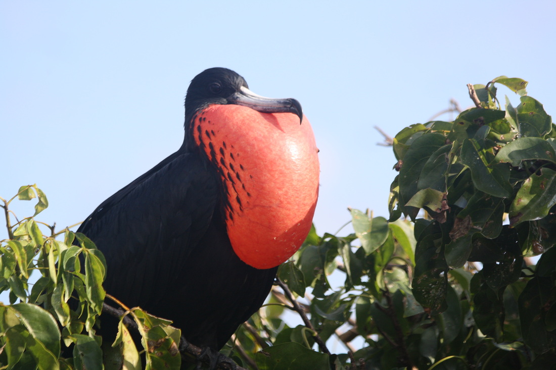
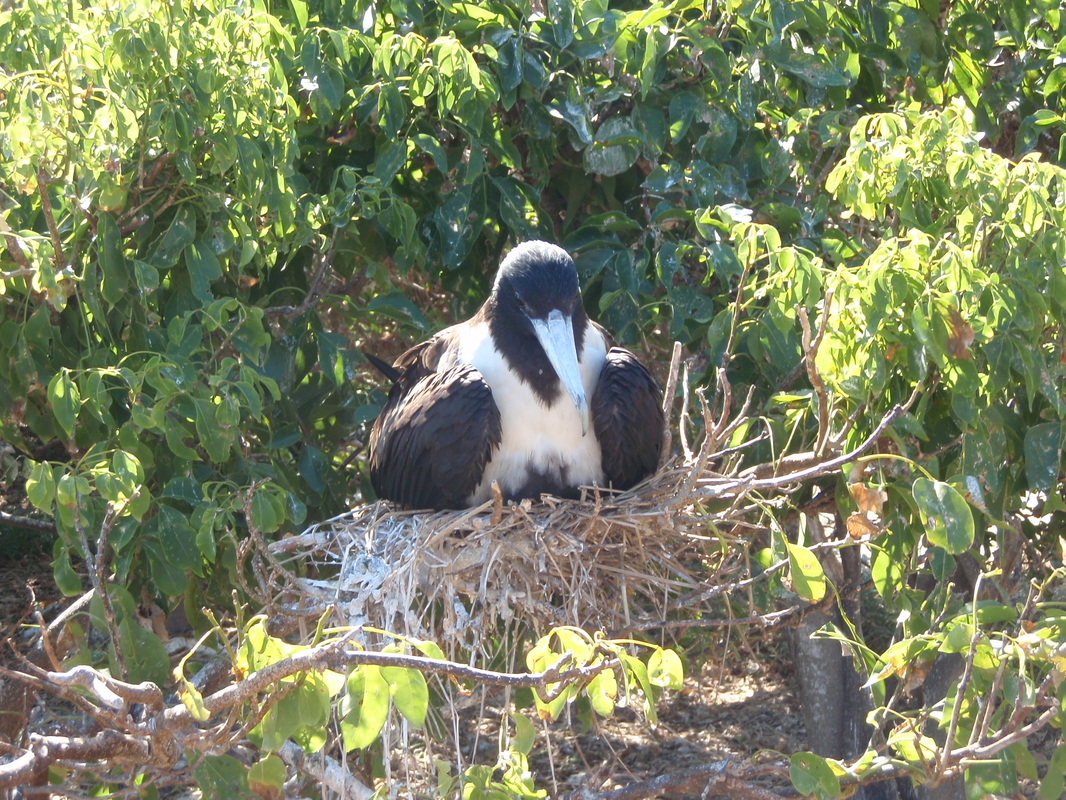
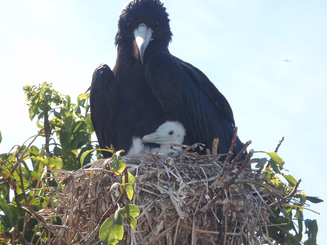
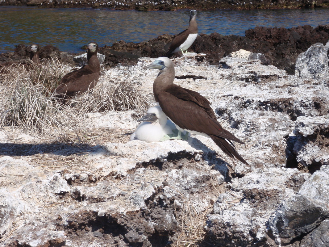
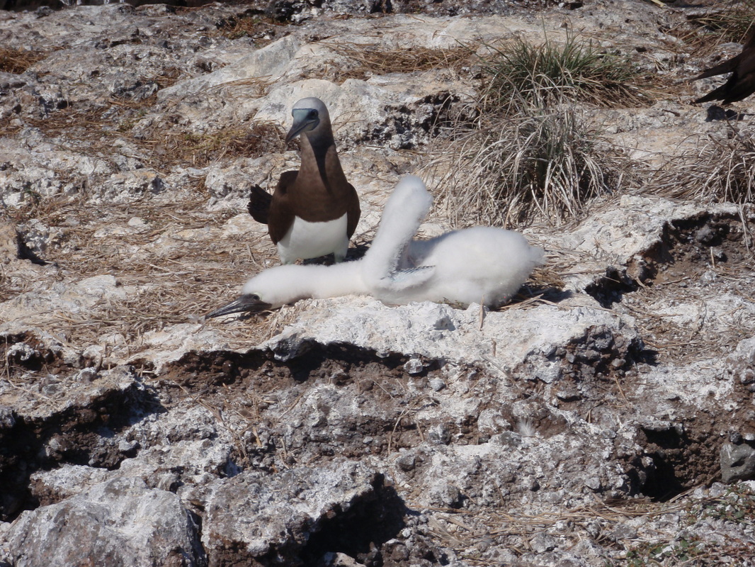
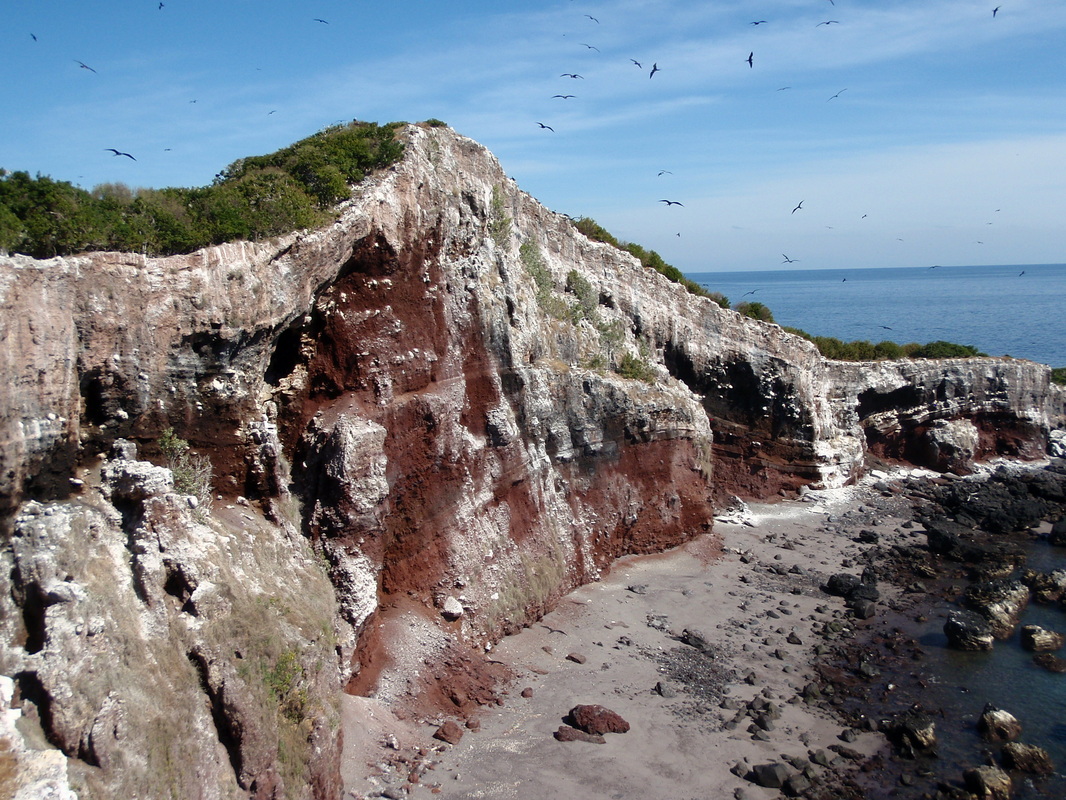
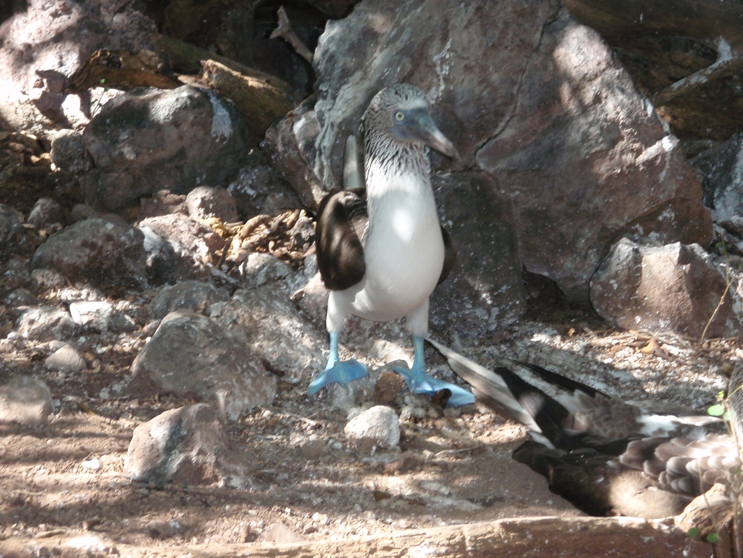
By the time the anchor drills were concluded, it was mid-afternoon, and we decided to wait until the next day to go exploring ashore. We sat in the cockpit, soaking in the late afternoon sun, drinking cold cervezas, watching the panga fishermen collect their nets, and marveling at all the birds flying back and forth overhead. The enormous number of birds that nest on the island, to include blue footed boobies and magnificent frigate birds, as well as the many resident iguanas, resulted in Isla Isabel being given national park status in 1981 (Parque Nacional Isla Isabel) and, in 2003, it was designated a World Heritage Site, affording protection at the international level, as well. As we sat in the cockpit watching the birds flying overhead, we saw something rather distressing that no amount of designating or protecting will help curtail – the frigates pick on the boobies, and it seems almost like a sport! The boobies will be flying back and forth, in amongst clouds of frigates birds, when all of a sudden, for no apparent reason, several frigates will chase off after a hapless boobie and when they get the boobie down to within 10 or 15 feet of the water, the frigates start grabbing the boobie’s tail or wings, which drops it into the water. Boobies swim, and frigates do not, so sometimes when a boobie is being chased it will land in the water first, to avoid being “plucked and dunked,” and when the frigates fly off, the boobie will too – often to be targeted for a second or third round of chasing and dunking before making it to shore, where the game seems to over. All of this is accompanied by a fair amount of squawking on the part of the boobies, who obviously do not see the humor in this little game. We didn’t either – we thought it was pretty rude!
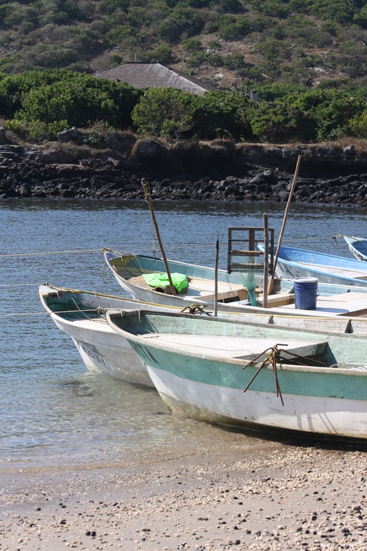
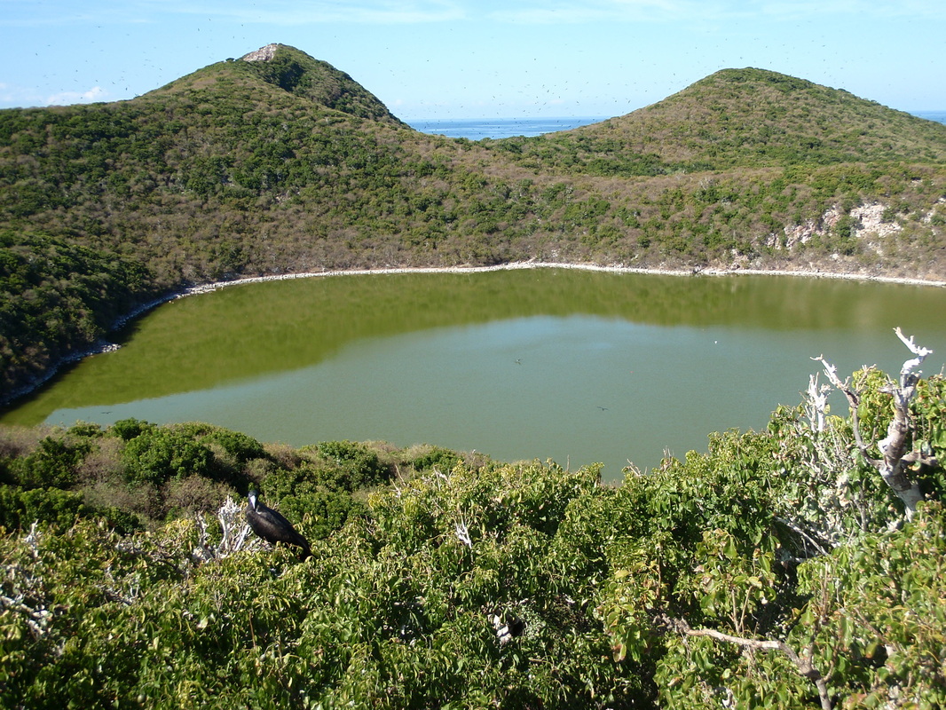
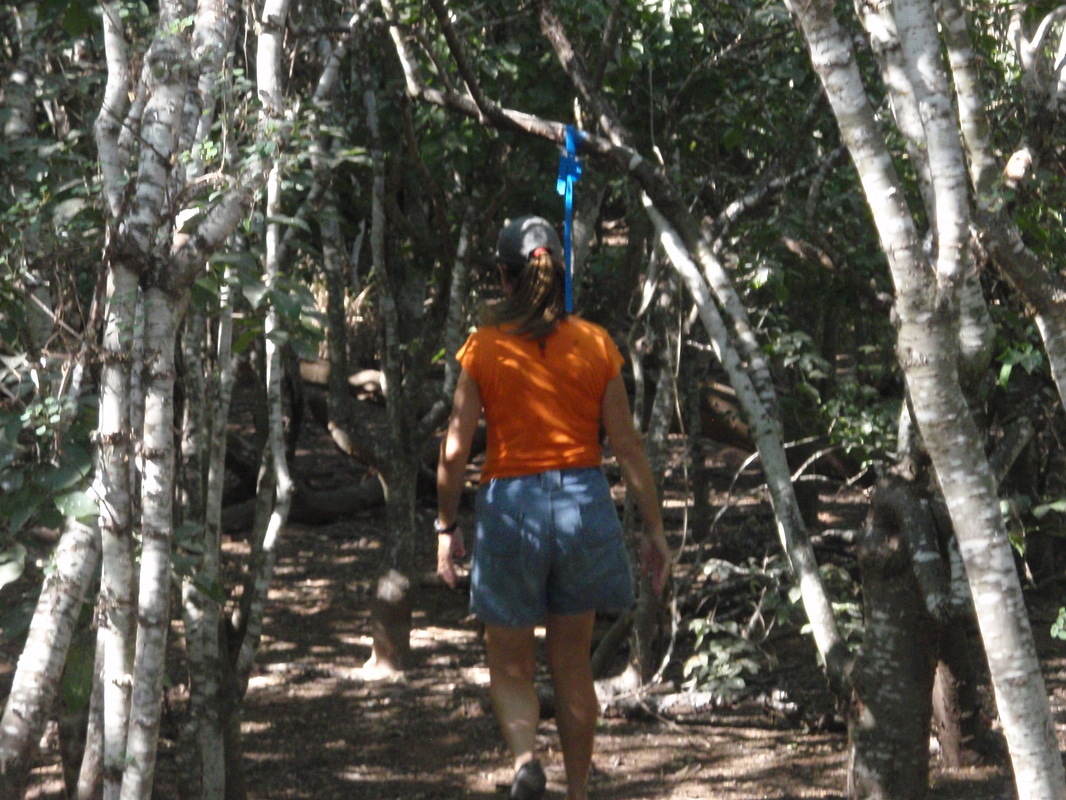
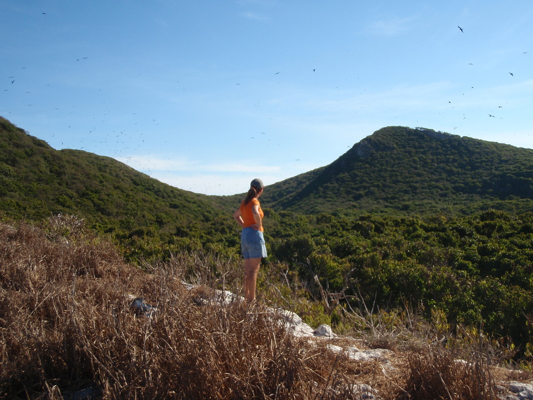
The next day, December 31, we set out early and kayaked around to the little bay on the south side of the island, and went ashore near the fish camp. The fishermen that were in were tending their nets, cutting up fish, or working on their boats (pangas), while the women attended to washing and cooking and kids played on the beach. A sign board near the southwest corner of the bay got us oriented to the trail system on the island, and we headed off to explore. There is an abandoned research station a little further to the southwest, near Playa Iguana (Iguana Beach), so we started off in that direction, walking under the “cover” of the low, almost scrub trees that cover the island, and in which the frigate birds land and nest. There are no natural predators on the island, so the birds, frigates and boobies alike, allow you to approach quite close. The noise the birds make, and the smell of guano, takes a little getting used to, but it was well worth it!
I paddled back to the boat, secured the kayak alongside, and woke Linda from her nap. I told her of our anchoring plight, and that we would have to weigh anchor and try again. This time, after finding what looked like a fairly large patch of sand, we dropped the anchor in 25 feet of water. When went to back down we heard the chain dragging over rock, felt it bump a time or two, then “thunk” – it grabbed hold with a jerk. We let the chain settle, then backed down again; this time, too, the boat jerked to a stop, and the chain was high when we stopped – we were firmly hooked, but on a rock, I was afraid. Fortunately, we had the trip line to help retrieve the anchor, if necessary – but wait, where was it? I could not see the float, which was our orange, 14-inch round fender, tethered to the anchor crown with 35 feet of floating polypropylene line. Finally I spotted the float – about 1 ½ feet under the waves! Even though we dropped anchor in 25 feet, and backed down toward the island, the anchor had apparently fallen into a “hole” and pulled the float down with it! I made a lasso out of 15 foot length of dock line, tied it to a small, white Styrofoam anchor trip line float, paddled back out to the sunken buoy and managed to get the lasso over and pulled up tight under the orange float. Good to go!
By the time the anchor drills were concluded, it was mid-afternoon, and we decided to wait until the next day to go exploring ashore. We sat in the cockpit, soaking in the late afternoon sun, drinking cold cervezas, watching the panga fishermen collect their nets, and marveling at all the birds flying back and forth overhead. The enormous number of birds that nest on the island, to include blue footed boobies and magnificent frigate birds, as well as the many resident iguanas, resulted in Isla Isabel being given national park status in 1981 (Parque Nacional Isla Isabel) and, in 2003, it was designated a World Heritage Site, affording protection at the international level, as well. As we sat in the cockpit watching the birds flying overhead, we saw something rather distressing that no amount of designating or protecting will help curtail – the frigates pick on the boobies, and it seems almost like a sport! The boobies will be flying back and forth, in amongst clouds of frigates birds, when all of a sudden, for no apparent reason, several frigates will chase off after a hapless boobie and when they get the boobie down to within 10 or 15 feet of the water, the frigates start grabbing the boobie’s tail or wings, which drops it into the water. Boobies swim, and frigates do not, so sometimes when a boobie is being chased it will land in the water first, to avoid being “plucked and dunked,” and when the frigates fly off, the boobie will too – often to be targeted for a second or third round of chasing and dunking before making it to shore, where the game seems to over. All of this is accompanied by a fair amount of squawking on the part of the boobies, who obviously do not see the humor in this little game. We didn’t either – we thought it was pretty rude!
The next day, December 31, we set out early and kayaked around to the little bay on the south side of the island, and went ashore near the fish camp. The fishermen that were in were tending their nets, cutting up fish, or working on their boats (pangas), while the women attended to washing and cooking and kids played on the beach. A sign board near the southwest corner of the bay got us oriented to the trail system on the island, and we headed off to explore. There is an abandoned research station a little further to the southwest, near Playa Iguana (Iguana Beach), so we started off in that direction, walking under the “cover” of the low, almost scrub trees that cover the island, and in which the frigate birds land and nest. There are no natural predators on the island, so the birds, frigates and boobies alike, allow you to approach quite close. The noise the birds make, and the smell of guano, takes a little getting used to, but it was well worth it!
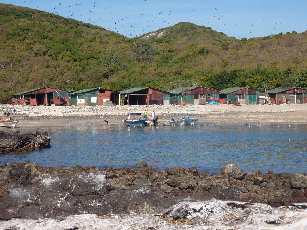

We found the research station “occupied” by students who camp there and who document the nesting and breeding habits of the birds on the island. When we found no iguanas at Playa Iguana, we headed back to the fish camp (where we found lots of iguanas) and then found the trailhead for the trail that goes all the way to the north end of the island, with branches of the main trail that take you to fabulous vistas overlooking the island and the surrounding waters. We spent the rest of the afternoon hiking these trails, and taking in the sights, sounds and smells! By 3:30 pm we were paddling back to Bright Angel to enjoy a subdued New Year’s Eve, as we prepared for an early morning passage back to the mainland and Ensenada Chacala, 55 nautical miles away.
(See the video on the Video Gallery that captures some the cacophony of the frigate birds!)
ISLA ISABEL TO ENSENADA CHACALA
Happy New Year! Bright and early (well, it was not quite bright yet!) at 5:45 am, we were up and getting ready to leave at first light. At 6:30 it was light enough to fire up the engine and start raising the anchor. With two days of anxiety built up over the prospect of being irrevocably fouled on a rock, we started motoring toward the anchor and hauling in chain as we went, all without incident as we got to within a yard or so of the trip line float, and almost directly over the anchor. Then, with a slight bump, the anchor started coming up – whew! (There is an anchor god!) After we retrieved the trip line, Linda started heading out away from the island as I finished stowing the anchor and gear on the foredeck, and in what had been reading 25 feet of water (and going up) we bumped the keel (lightly) on a rock pinnacle – twice – as the boat rose and fell in the swell – as if the anchor god was saying “You owe me!”
The panga fishermen were already setting their nets around the island, so we made a few turns to the south and west to avoid them, before coming back on our southeasterly rhumb line to Chacala. Then we saw whales not far ahead – several of them – heading north, so we turned south again to avoid them. When we were clear, we turn SE again, and got back on course. By 8:00 am the wind was building nicely, at 9-12 knots out of the NE, with a gentle, long period swell, so we rigged the Monitor wind vane, set the sails, and turned off the engine. It was a picture perfect morning, as Isla Isabel slipped away behind us, the anchor was aboard, manta rays were jumping, and the sun was climbing and warming things up nicely without a cloud in the sky! I fussed with balancing the sails and tried to get the Monitor to cooperate, and was just about to give up and hand steer the boat when Linda said – “Maybe it needs a woman’s touch.” Within a minute or two she had the Monitor set and driving the boat right down the rhumb line on a beam reach!
We sailed along under sunny skies on flat seas with diamonds dancing on the water until just after noon, when the wind died down to around 5-6 knots, giving us a boat speed of around 3 knots or less. As our speed slowed, the chart plotter kept recalculating our arrival time at Chacala, which had been an ideal 4:30 pm, back up to around midnight. It was time to start the motor again! Soon the arrival time was back to 4:30. After we got the autopilot set, I went to work digging the stern anchor (a Fortress FX-37) out of the bottom of the lazarette, where it had been stowed since we left Port Townsend, and rigging the stern anchor rode (15 feet of 3/8" chain, and 250 feet of 5/8" 8-strand nylon brait for possible deployment in Ensenada Chacala. The cruising guide warned that with moderate to strong northerlies, swell can wrap around into the anchorage and that a stern anchor might be necessary to hold the bow into the swell and preclude rolling side-to-side. We had never deployed the stern anchor, but we wanted to be ready to do so if necessary, and would not have time to set things up before dark once we were in the anchorage.
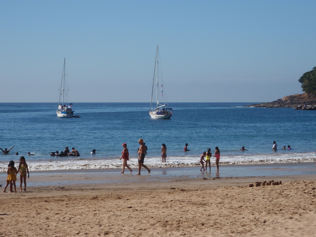
When we arrived at Chacala, the water in the bay was calm, with only a slight swell. Nevertheless, all six of the other boats in the relatively small anchorage had stern anchors out, so we would have to use ours as well, to avoid swinging at anchor when the other boats near us would not. We dropped our bow anchor in 25 feet of water (over a sand bottom this time, thank you very much!), backed down to set it with 4-1 scope, and then continued letting out chain until we had almost 200 feet out. We then simply dropped the stern anchor over the stern, and began taking in the excess bow anchor rode. We snubbed the stern anchor at around 50 feet of rode, it set firmly, and then we continued to take up more of the excess bow anchor chain until we were back to around 5-1 scope. We let out more stern anchor rode as we took in the bow chain, and then tightened it up when were done. The whole process was as simple as that, and worked like a charm. After we set the snubber bridle on the bow anchor chain, we settled back in the cockpit with hors d’oeuvres and champagne to toast the New Year, and watched one of the most incredible sunsets we had seen in a long time! As the evening wore on, so did the music and partying on shore at the palapas that line the palm fringed sandy beach – a Happy New Year indeed!
ISLA ISABEL TO ENSENADA CHACALA
Happy New Year! Bright and early (well, it was not quite bright yet!) at 5:45 am, we were up and getting ready to leave at first light. At 6:30 it was light enough to fire up the engine and start raising the anchor. With two days of anxiety built up over the prospect of being irrevocably fouled on a rock, we started motoring toward the anchor and hauling in chain as we went, all without incident as we got to within a yard or so of the trip line float, and almost directly over the anchor. Then, with a slight bump, the anchor started coming up – whew! (There is an anchor god!) After we retrieved the trip line, Linda started heading out away from the island as I finished stowing the anchor and gear on the foredeck, and in what had been reading 25 feet of water (and going up) we bumped the keel (lightly) on a rock pinnacle – twice – as the boat rose and fell in the swell – as if the anchor god was saying “You owe me!”
The panga fishermen were already setting their nets around the island, so we made a few turns to the south and west to avoid them, before coming back on our southeasterly rhumb line to Chacala. Then we saw whales not far ahead – several of them – heading north, so we turned south again to avoid them. When we were clear, we turn SE again, and got back on course. By 8:00 am the wind was building nicely, at 9-12 knots out of the NE, with a gentle, long period swell, so we rigged the Monitor wind vane, set the sails, and turned off the engine. It was a picture perfect morning, as Isla Isabel slipped away behind us, the anchor was aboard, manta rays were jumping, and the sun was climbing and warming things up nicely without a cloud in the sky! I fussed with balancing the sails and tried to get the Monitor to cooperate, and was just about to give up and hand steer the boat when Linda said – “Maybe it needs a woman’s touch.” Within a minute or two she had the Monitor set and driving the boat right down the rhumb line on a beam reach!
We sailed along under sunny skies on flat seas with diamonds dancing on the water until just after noon, when the wind died down to around 5-6 knots, giving us a boat speed of around 3 knots or less. As our speed slowed, the chart plotter kept recalculating our arrival time at Chacala, which had been an ideal 4:30 pm, back up to around midnight. It was time to start the motor again! Soon the arrival time was back to 4:30. After we got the autopilot set, I went to work digging the stern anchor (a Fortress FX-37) out of the bottom of the lazarette, where it had been stowed since we left Port Townsend, and rigging the stern anchor rode (15 feet of 3/8" chain, and 250 feet of 5/8" 8-strand nylon brait for possible deployment in Ensenada Chacala. The cruising guide warned that with moderate to strong northerlies, swell can wrap around into the anchorage and that a stern anchor might be necessary to hold the bow into the swell and preclude rolling side-to-side. We had never deployed the stern anchor, but we wanted to be ready to do so if necessary, and would not have time to set things up before dark once we were in the anchorage.
When we arrived at Chacala, the water in the bay was calm, with only a slight swell. Nevertheless, all six of the other boats in the relatively small anchorage had stern anchors out, so we would have to use ours as well, to avoid swinging at anchor when the other boats near us would not. We dropped our bow anchor in 25 feet of water (over a sand bottom this time, thank you very much!), backed down to set it with 4-1 scope, and then continued letting out chain until we had almost 200 feet out. We then simply dropped the stern anchor over the stern, and began taking in the excess bow anchor rode. We snubbed the stern anchor at around 50 feet of rode, it set firmly, and then we continued to take up more of the excess bow anchor chain until we were back to around 5-1 scope. We let out more stern anchor rode as we took in the bow chain, and then tightened it up when were done. The whole process was as simple as that, and worked like a charm. After we set the snubber bridle on the bow anchor chain, we settled back in the cockpit with hors d’oeuvres and champagne to toast the New Year, and watched one of the most incredible sunsets we had seen in a long time! As the evening wore on, so did the music and partying on shore at the palapas that line the palm fringed sandy beach – a Happy New Year indeed!
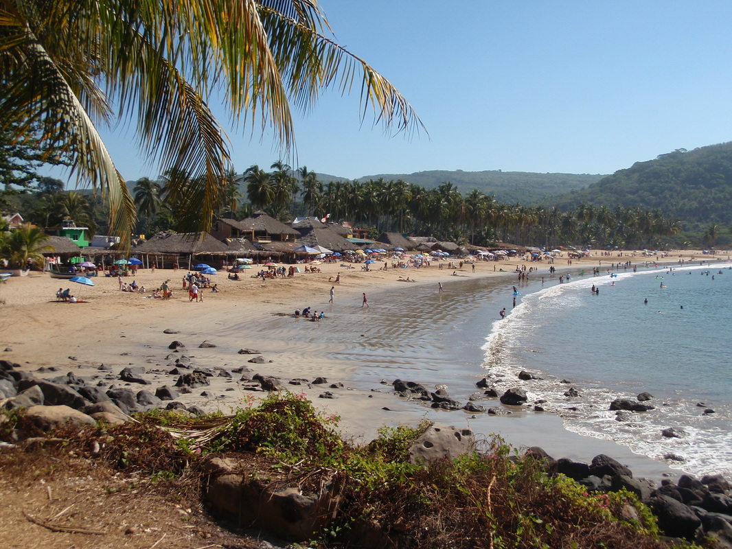

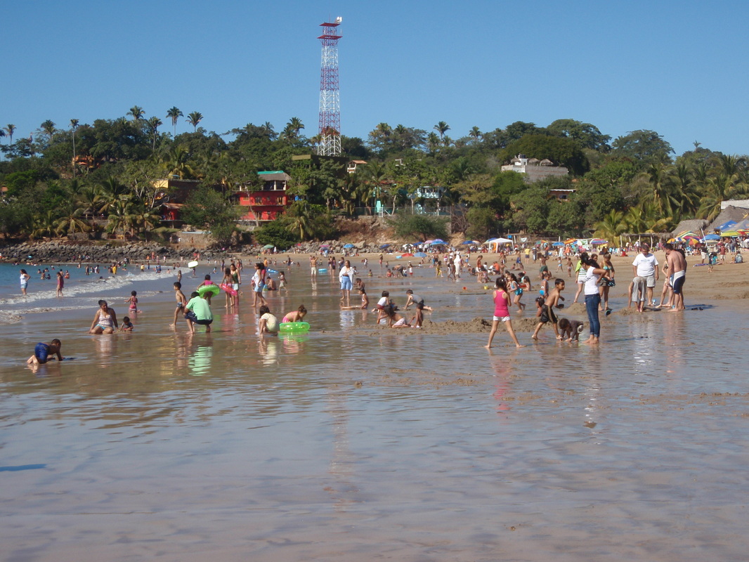
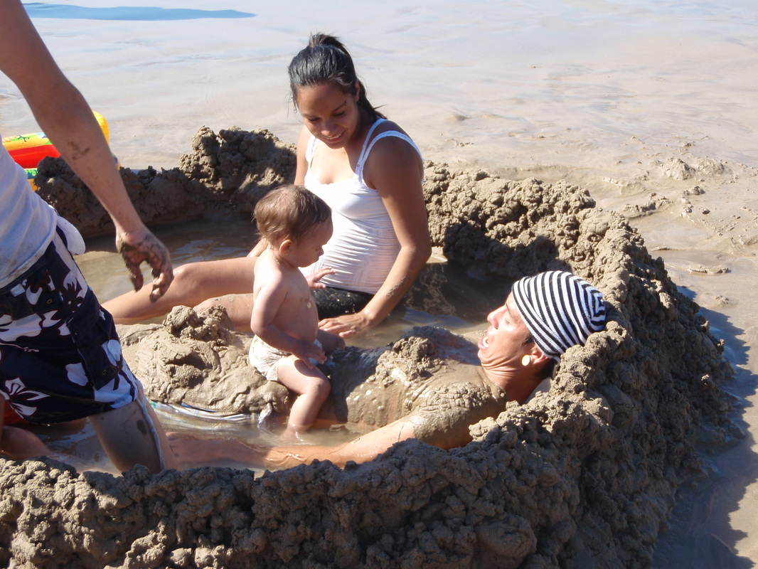
The next day we took the dinghy ashore on a small sandy beach near the panga dock, and spent the day exploring the quaint town of Chacala, and the wonderful beach with its multitude of restaurants and bars, strolling musicians, and hundreds of people – mostly Mexicans! This is very popular resort town with several hotels and numerous establishments with rooms for rent. When the Mexicas go on holiday, it is very much a family affair – we had the most fun watching them having fun!


CHACALA TO LA CRUZ de HUANACAXTLE
We spent two nights at anchor in Ensenada Chacala, and then weighed both anchors (by simply reversing the process we used to set them) by 6:45 am on January 3, 2011, and headed back out and down the coast for the 43 mile run to La Cruz in Banderas Bay. Along the way we saw more whales, sea turtles, and leaping manta rays. As we pulled into our slip in the new Marina Riviera Nayarit at La Cruz, there were eight people on the finger pier to catch our lines (this was not the time to mess up the approach, and fortunately I didn’t!) – two marina employees, and six of our cruiser friends from three other boats – Hugh and Anne Jenings, Serendipity (Port Ludlow, WA), Tom and Lori Jeremiason, Camelot (Alameda, CA), and Gene and Tami Reynolds, Andiamo III (Olympia, WA). What a Grand Welcome to help us open another chapter in this Grand Adventure!
We spent two nights at anchor in Ensenada Chacala, and then weighed both anchors (by simply reversing the process we used to set them) by 6:45 am on January 3, 2011, and headed back out and down the coast for the 43 mile run to La Cruz in Banderas Bay. Along the way we saw more whales, sea turtles, and leaping manta rays. As we pulled into our slip in the new Marina Riviera Nayarit at La Cruz, there were eight people on the finger pier to catch our lines (this was not the time to mess up the approach, and fortunately I didn’t!) – two marina employees, and six of our cruiser friends from three other boats – Hugh and Anne Jenings, Serendipity (Port Ludlow, WA), Tom and Lori Jeremiason, Camelot (Alameda, CA), and Gene and Tami Reynolds, Andiamo III (Olympia, WA). What a Grand Welcome to help us open another chapter in this Grand Adventure!